Back to selection
GEO Satellite
APSTAR-7 GEO
succesfull

Active
Launch date
31 March 2012
Dedicated Mission
Country

Purpose
Communication
Position
76,5° East
Manufacturer
Operator
Launch operator
Launch vehicle
Long March 3B (CZ-3B)
Expected lifetime
15+ Years

Regions
Asia Pacific Region
Europe Region
North & Central Africa Region
Oceania Region
South Africa Region
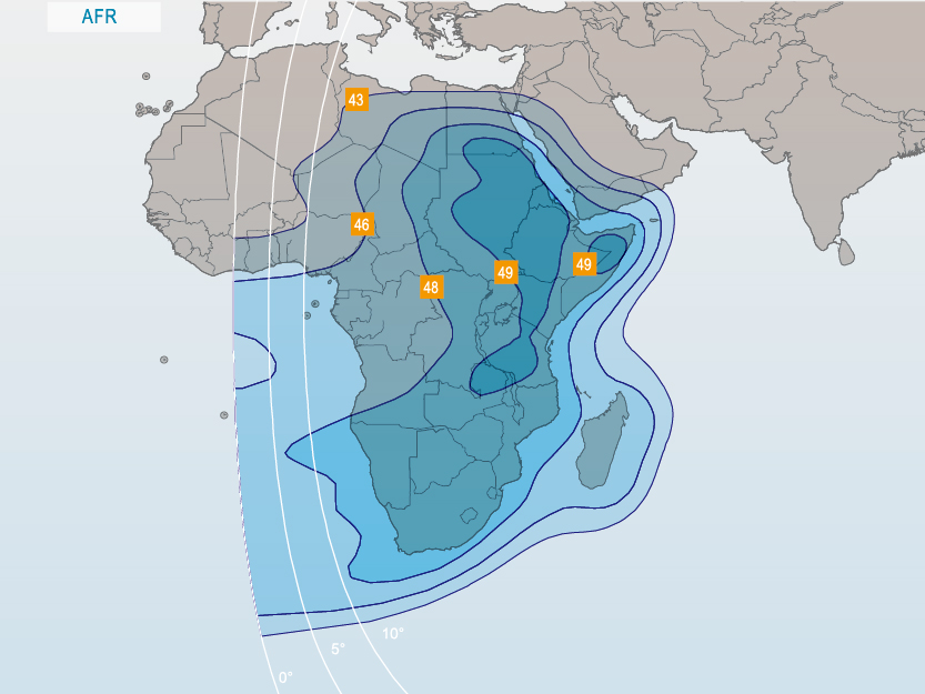
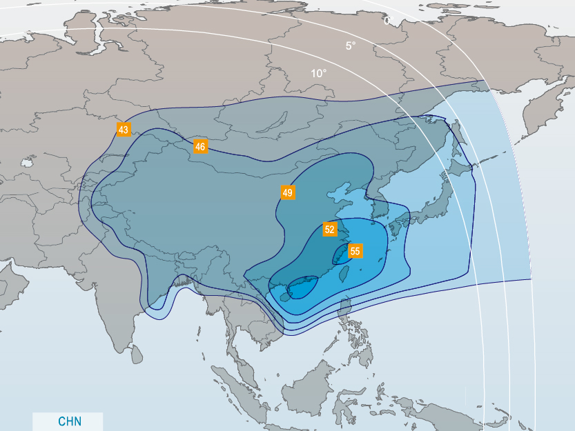
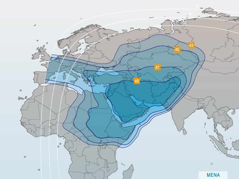
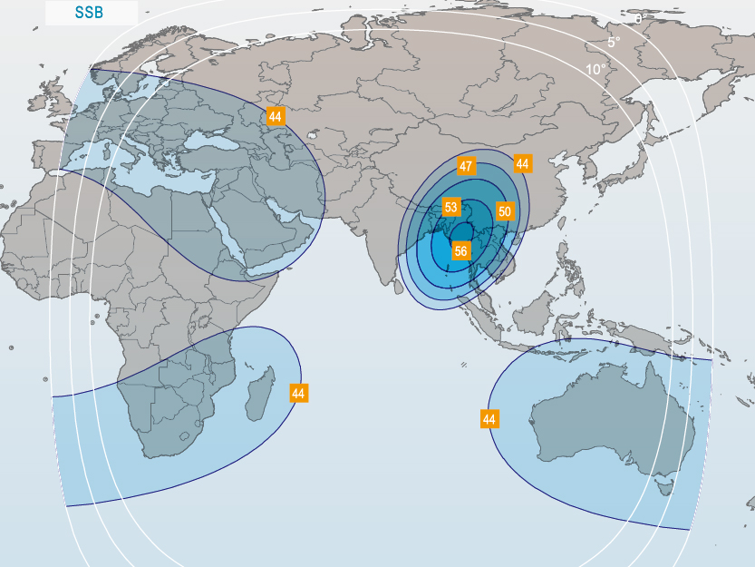
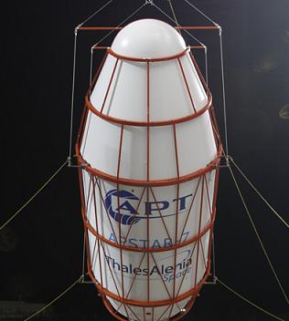
The APSTAR-7 satellite is located at 76,5° East Geostationary orbit covering Asia, Europe, Australia and Africa in C-band and China. Middle-East and Africa in steerable Ku-band.
The spacecraft was constructed by Thales Alenia Space as an ITAR-free satellite, containing no restricted American components. The USA prohibits the export of satellite components when a Chinese launcher will be used. Ironically, the US Department of Defense leased bandwidth on APSTAR-7 in May 2012 to improve communications with the U.S. Africa Command. In 2013, Thales Alenia Space was forced to discontinue its ITAR-free satellite line after US supplier Aeroflex admitted that it had sold them ITAR-controlled components.
The 5,054kgs heavy APSTAR-7 satellite was launched on March 31st, 2012 by launch operator CGWIC from China on a Long March CZ/3B rocket. The satellite has a planned operational lifespan of over 15 years.
GEO Satellite
APSTAR-7
succesfull
GEO Satellite
APSTAR-7
succesfull
GEO Satellite
APSTAR-7
succesfull