
Back to selection
GEO Satellite
GOES-S (GOES-17) GEO
succesfull

Active
Launch date
1 March 2018
Dedicated Mission
Country

Purpose
Weather Forecasting
Position
137.3° West
Operator
National Oceanic and Atmospheric Administration (NOAA)
Launch vehicle
Atlas V
Expected lifetime
15+ Years
GOES-17 (GOES-S): NOAA’s Next-Gen Geostationary Weather Satellite
Overview
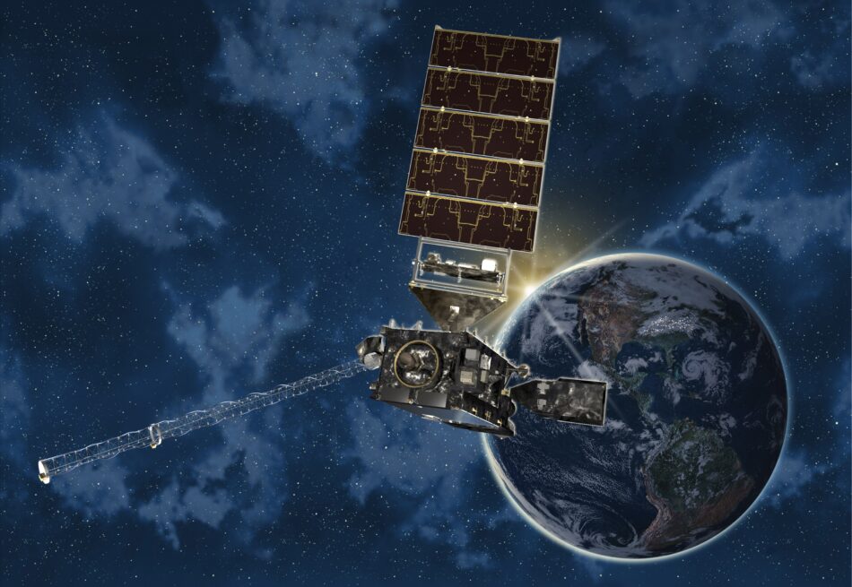
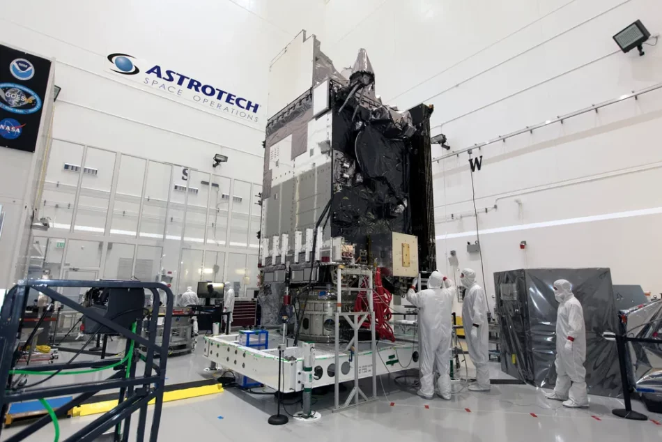
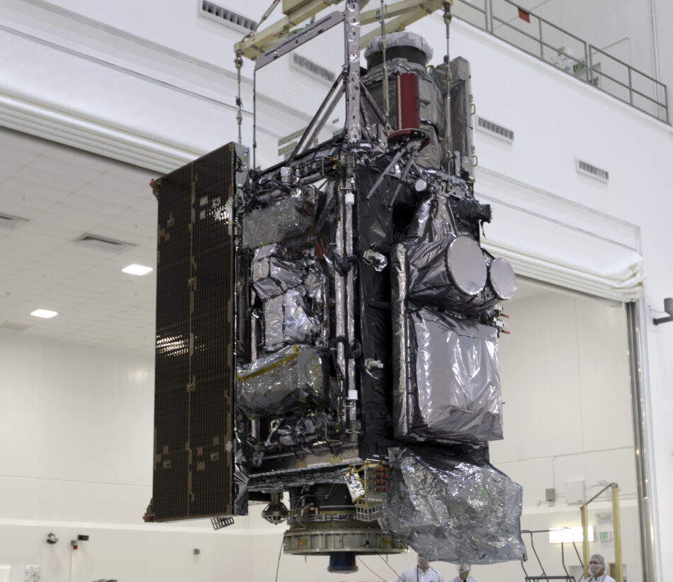
GOES-17, originally known as GOES-S, is the second satellite in NOAA’s GOES-R Series, which also includes GOES-16, GOES-18 (GOES-T), and GOES-U. Launched on March 1, 2018, aboard a ULA Atlas V 541 rocket from Cape Canaveral, GOES-17 became operational as GOES-West on February 12, 2019. Positioned at 137.2° West, it covers the western United States, Hawaii, and much of the Pacific Ocean, delivering advanced weather data and near-real-time environmental imagery.
Built by Lockheed Martin on the A2100A satellite bus, GOES-17 supports NOAA’s mission with high-resolution visible and infrared imaging, lightning mapping, and space weather monitoring, with a 15-year design life (10 years operational + 5 years standby).
Key Capabilities & Benefits
-
Real-time monitoring of wildfires, smoke, and dust
-
Enhanced low cloud and fog detection
-
Better tropical cyclone tracking and intensity forecasts
-
More accurate air quality alerts
-
Improved aviation and transportation safety
-
Monitoring of atmospheric rivers that cause floods and mudslides
-
Supports Search and Rescue (SARSAT) via GEOSAR system
-
Complements GOES-16 (GOES-East) to provide near-complete coverage of the Western Hemisphere
Malfunction & Mitigation
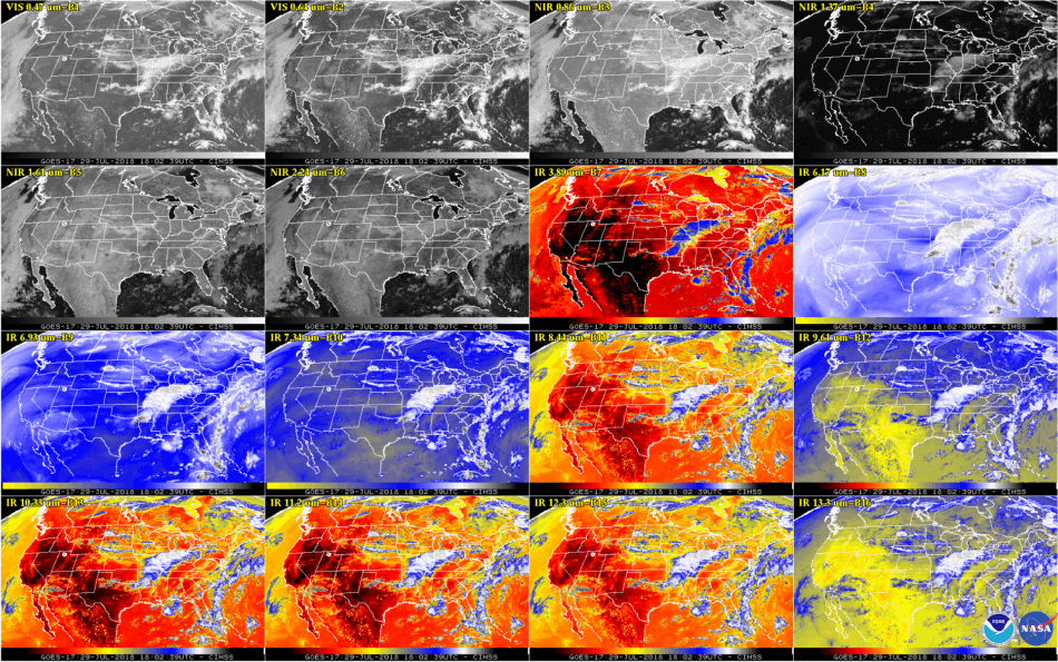
Shortly after launch, a critical cooling failure was discovered in the satellite’s Advanced Baseline Imager (ABI). The issue was traced to a loop heat pipe (LHP) manufactured by Orbital ATK, which affected infrared and near-infrared imaging, especially during warmer months. The root cause was later identified as foreign object debris (FOD) inside the LHP.
NOAA implemented thermal mitigation strategies and software workarounds to preserve partial ABI functionality:
-
Up to 13 of 16 infrared channels remain usable most of the year
-
Performance varies seasonally, with better operation during solstice periods
-
GOES-15 and GOES-17 operated in tandem through 2020; GOES-15 was reactivated temporarily for redundancy
The failure led to a design revision for future satellites. The ABI on GOES-T (now GOES-18) was rebuilt, and a switch to ammonia coolant was implemented.
Operational Adjustments
GOES-17 drifted to its final position at 137.2°W after testing. Despite the ABI anomaly, it continued delivering valuable data. In 2023, GOES-18 replaced GOES-17 as the primary GOES-West satellite, with GOES-17 now in backup/on-orbit storage at 105°W.
Mission Objectives
GOES-17 is part of NOAA’s strategy to improve:
-
Weather forecasting accuracy
-
Severe storm tracking
-
Lightning detection
-
Solar activity and space weather monitoring
-
Environmental risk assessment
With 4x higher resolution and 5x faster scanning than previous GOES satellites, GOES-17 and its sister satellites represent a major leap in real-time Earth observation.
GEO Satellite
GOES-S (GOES-17)
succesfull
GEO Satellite
GOES-S (GOES-17)
succesfull
GEO Satellite
GOES-S (GOES-17)
succesfull