Back to selection
GEO Satellite
MEASAT-3 GEO
succesfull

Lost
Launch date
11 December 2006
Dedicated Mission
Country

Purpose
Communication
Position
46° East
Manufacturer
Operator
Launch operator
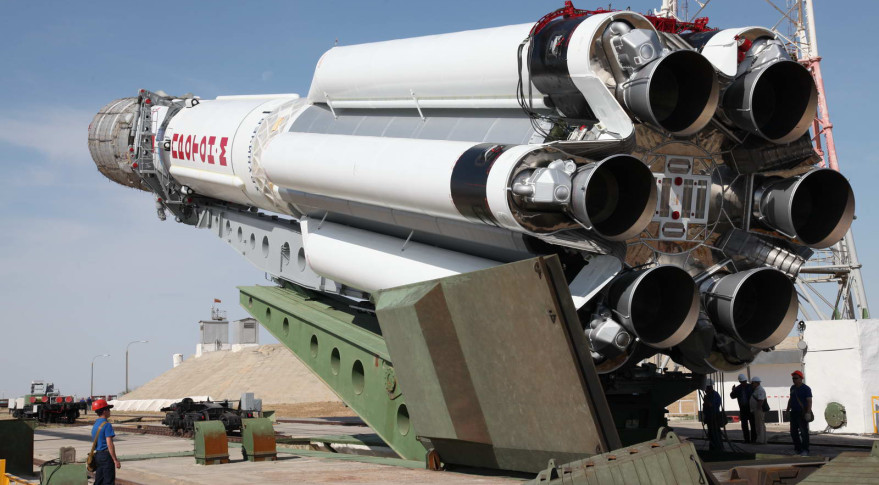
Launch vehicle
Proton M/Breeze
Expected lifetime
15+ Years

Regions
Europe Region
Middle East Region
North & Central Africa Region
Oceania Region
South Africa Region
In March 2003 MEASAT Satellite Systems Sdn. Bhd. ordered a Boeing 601HP satellite, giving it the designation MEASAT-3 at that time. MEASAT-3 joined the existing Boeing-built MEASAT-1 and MEASAT-2 spacecraft in the Malaysia-East Asia Satellite system.
MEASAT-3 was launched on December 11th, 2006 by launch operator ILS using a Proton-M rocket with a Briz-M upper stage. The upper stage made five burns to place MEASAT-3 into a geostationary transfer orbit.
After circularisation and testing, the satellite entered commercial service on January 25, 2007, in geostationary orbit at a longitude of 91.5° East where it is co-located with
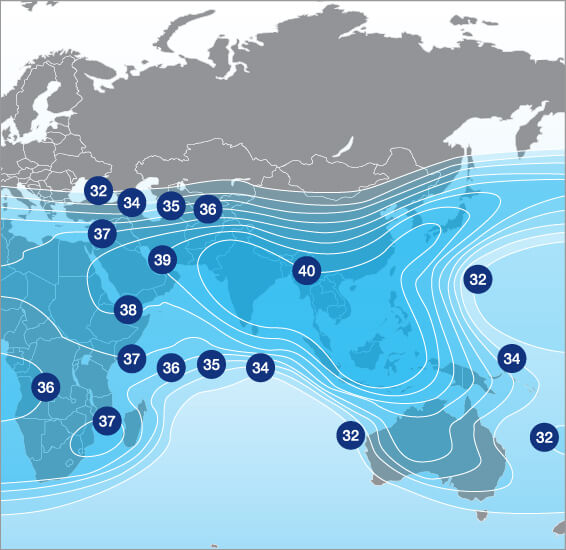
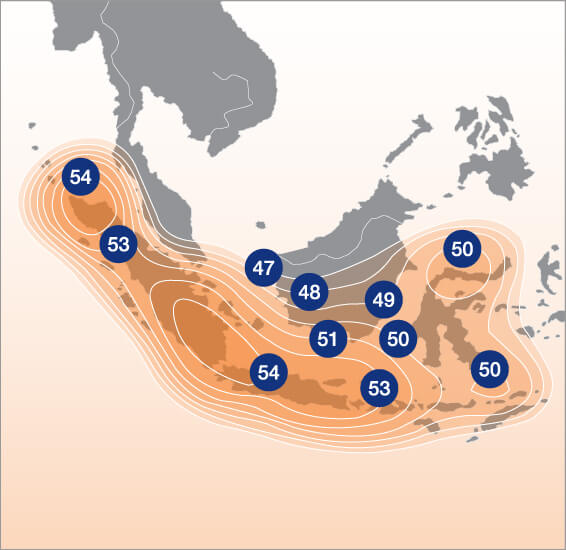
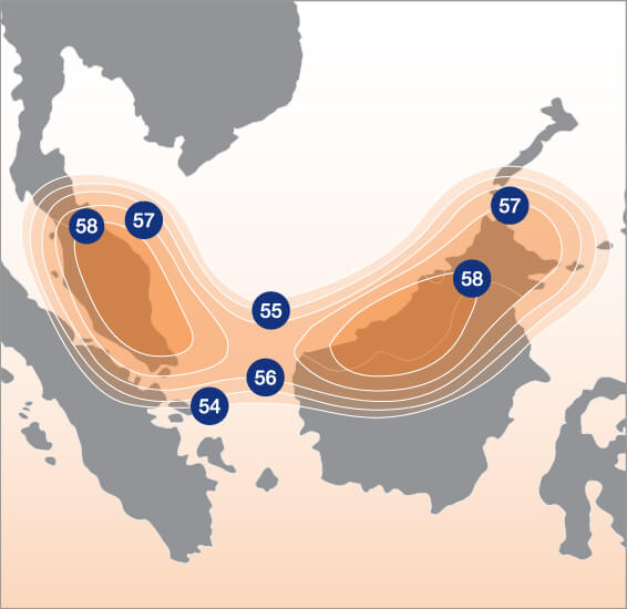
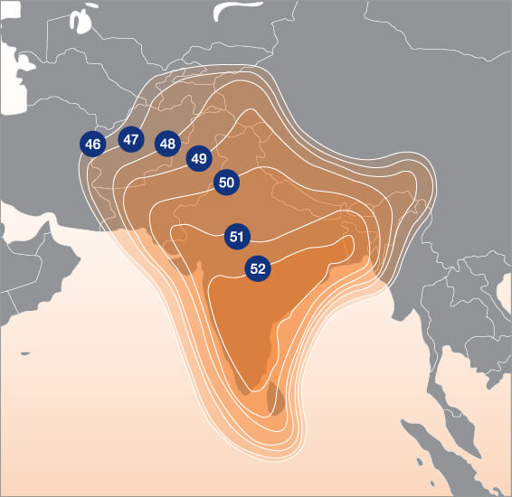
MEASAT-1. The C- band and Ku-band covered geographically remote areas such as Sabah, Sarawak, and NorthIndia and expands the MEASAT fleet’s coverage to more than 100 countries embracing Australia, Middle-East, Eastern Europe and Africa.
In June 2021 the satellite suffered from anomalies and MEASAT satellite operator was not able to salvage the spacecraft. MEASAT-3 was declared total-loss and de-orbited in August 2021. MEASAT’s replacement satellite, MEASAT-3d will restore the regional broadcasting services mid 2022 when this satellite will be launched.
GEO Satellite
MEASAT-3
succesfull
GEO Satellite
MEASAT-3
succesfull
GEO Satellite
MEASAT-3
succesfull